


Garfield Voting District, Whitman County, Washington
About
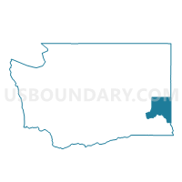
Outline

Summary
| Unique Area Identifier | 690109 |
| Name | Garfield Voting District |
| County | Whitman County |
| State | Washington |
| Area (square miles) | 73.33 |
| Land Area (square miles) | 73.33 |
| Water Area (square miles) | 0.00 |
| % of Land Area | 100.00 |
| % of Water Area | 0.00 |
| Latitude of the Internal Point | 47.01020530 |
| Longtitude of the Internal Point | -117.14682510 |
Maps


Graphs
Select a template below for downloading or customizing gragh for Garfield Voting District, Whitman County, Washington


Neighbors
Neighoring Voting District (by Name) Neighboring Voting District on the Map
- Voting District 057020, Latah County, ID
- Voting District 057026, Latah County, ID
- Voting District 057031, Latah County, ID
- Farmington Voting District, Whitman County, WA
- North Colfax Voting District, Whitman County, WA
- Oakesdale Voting District, Whitman County, WA
- Palouse Rural Voting District, Whitman County, WA
- Steptoe Voting District, Whitman County, WA
Top 10 Neighboring County Subdivision (by Population) Neighboring County Subdivision on the Map
- Colfax-Palouse CCD, Whitman County, WA (5,041)
- Potlatch CCD, Latah County, ID (3,817)
- Garfield-Oakesdale CCD, Whitman County, WA (1,987)
Top 10 Neighboring Place (by Population) Neighboring Place on the Map
Top 10 Neighboring Unified School District (by Population) Neighboring Unified School District on the Map
- Colfax School District, WA (3,985)
- Potlatch School District 285, ID (3,281)
- Palouse School District, WA (1,391)
- Oakesdale School District, WA (837)
- Garfield School District, WA (789)
- Steptoe School District, WA (281)